By Natalie Sopinka with geologic descriptions by Ken Buchan

Larose Forest guide now on sale!
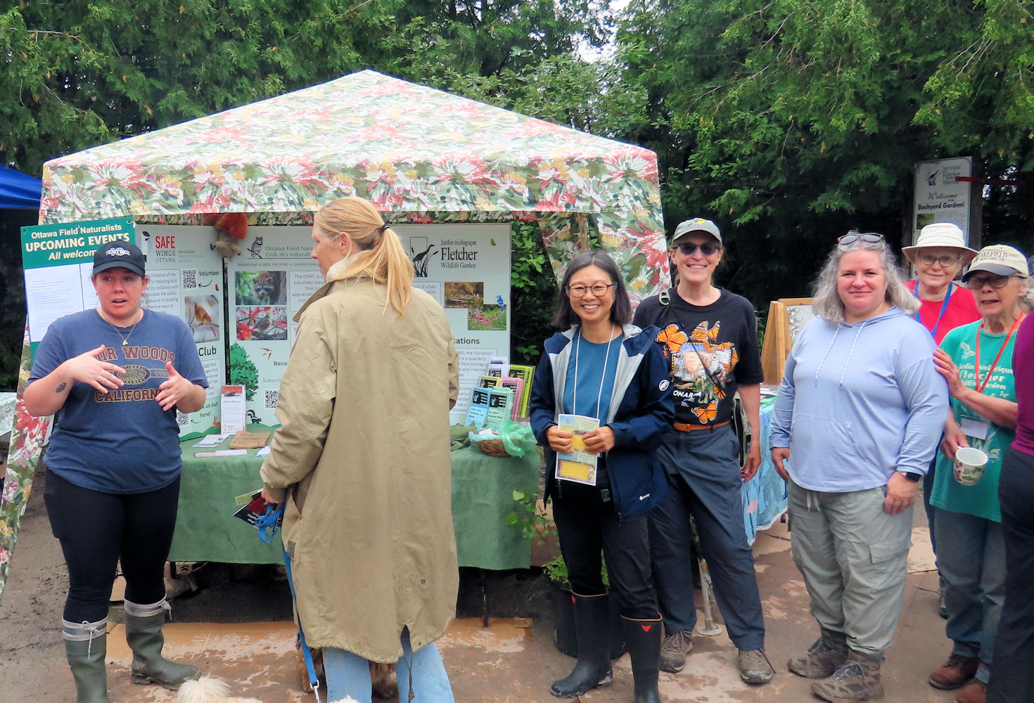
At the club’s second last meeting before summer, Linda Burr (Education & Publicity Committee) unveiled the OFNC’s first bilingual publication The Larose Forest, a Naturalist’s Guide. On sale now for $4, the guide includes a description of the forest’s history and habitats by OFNC member Christine Hanrahan, species lists of birds, mammals, herps, butterflies, odonates and vascular plants, plus a colour map of the forest trails. Birding (June 8), mothing (June 13) and butterfly (June 22) walks will be held in the Larose Forest next month. Event details are on the OFNC website.
Emma Kirke, one of the OFNC award winners at the Ottawa Regional Science Fair, was also at the meeting and shared her display on tree crown shape and wind resistance.
Murray Citron captivated the audience with his poetic memories of the “seaside spectacle” that is Newfoundland. While relating tectonic plates to Titans, Murray noted that “where there is geology, there is Greek mythology.”
Where there is geology there may also be a geophysicist like Ken Buchan. In between canoe trips, Ken is a dedicated board member of the Algonquin to Adirondacks (A2A) Collaborative and spoke to OFNC members about the group’s conservation efforts.
The A2A Collaborative’s mission is to “protect, restore, enhance and maintain” connections for wildlife that inhabit and move within the Algonquin to Adirondacks region. The region has a rich geological history that Ken shared. He described how, starting 1300 million years ago, continental collisions formed the Grenville Mountains along the southeastern margin of the Precambrian Canadian Shield. Over hundreds of millions of years they were eroded and partly covered with flat-lying sedimentary rocks to produce the landscape we see today in the A2A region. The Algonquin Highlands and the Adirondack Mountains, as well as the Frontenac Arch which connects them, are part of the Canadian Shield. Although valiant efforts were made to farm on the Arch in the 19th century, it proved unsuitable for agriculture and much of the area has since been reforested. Immediately to the southeast of the A2A region, the Appalachian Mountains were formed during a later series of continental collisions beginning at about 450 million years ago.
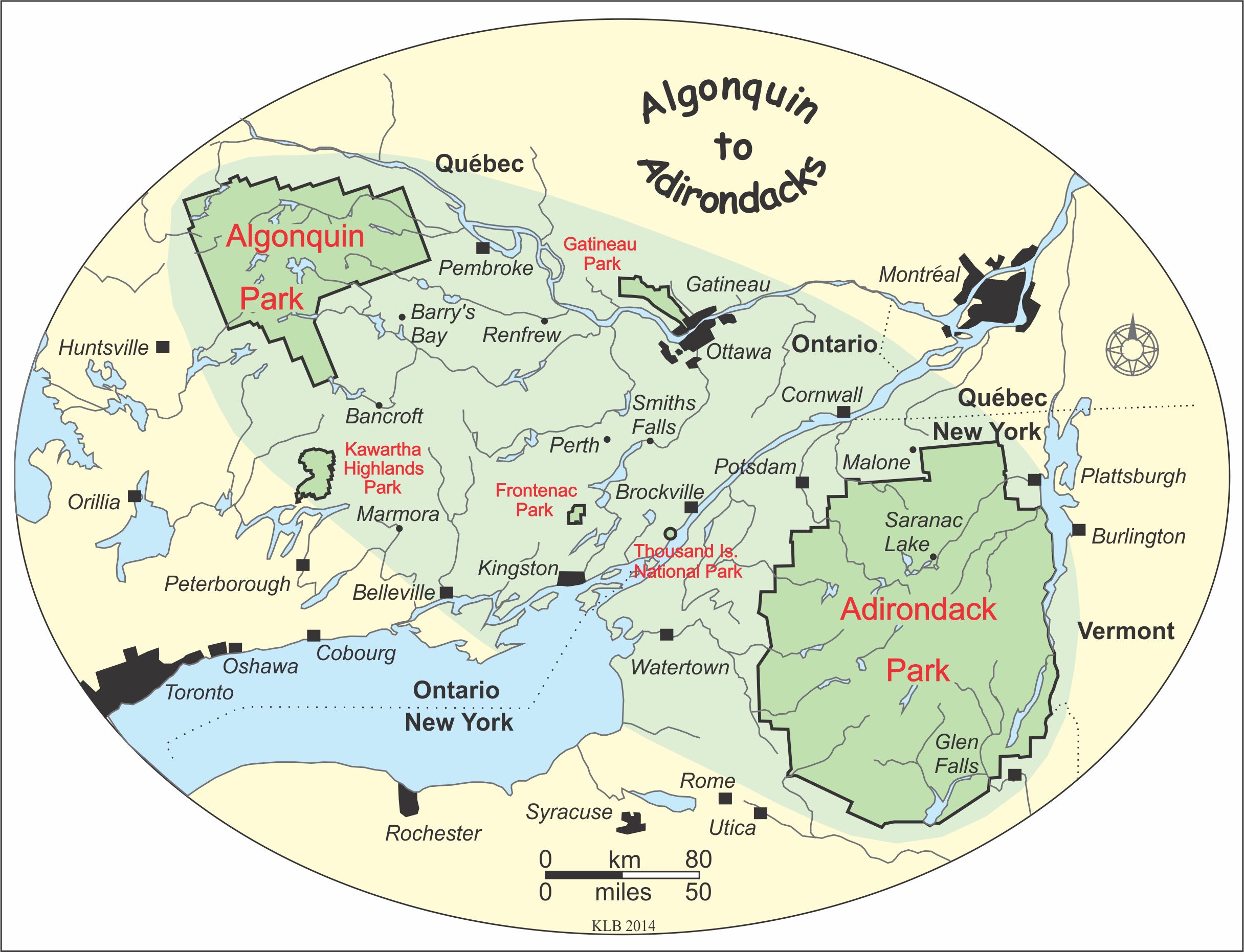
The cities of Ottawa and Gatineau are located within the Algonquin to Adirondacks region. Map by Ken Buchan.
Working alongside Canadian and American NGOs, universities, land trusts, naturalist clubs, government agencies and cottage associations, the A2A Collaborative is:
1. Identifying A2A connections in forests, wetlands, rivers and island chains with comprehensive mapping. Whether it’s large mammals moving through forested landscapes, lake sturgeon migrating within river systems or small mammals and birds utilizing island chains, identifying and recording A2A connections can help ensure they are not severely altered.
2. Identifying threats to A2A connections. Habitat fragmentation, roads/highways, aquatic pollution, hydroelectric dams, proposed tar sands pipelines, climate change, urban sprawl, inappropriate recreational use and wind turbine placement can all compromise the integrity of A2A connections.
3. Maintaining and restoring A2A connections. The collaborative is working with its partners on a number of research and monitoring projects including ones that focus on protecting species at risk (e.g., in watersheds and important bird areas), habitat restoration and road ecology along Highway 401.
4. Developing an online database. To facilitate collaboration and sharing of important information among partners, the collaborative is in the process of creating an online database to catalog data for use by organizations working in the A2A region.
Be sure to visit the A2A Collaborative’s website to learn more about its projects and how you can get involved and support the A2A initiative.

A view from the Precambrian Canadian Shield on the Eardley Escarpment in Gatineau Park, looking east over the Paleozoic sedimentary rocks and farmland of the Ottawa River valley. Photo by Ken Buchan.